Ad Clicks : Ad Views : Ad Clicks : Ad Views : Ad Clicks : Ad Views : Ad Clicks : Ad Views :
Oh Snap!

It looks like you're using an adblocker. Adblockers make us sad. We use ads to keep our content happy and free. If you like what we are doing please consider supporting us by whitelisting our website. You can report badly-behaved ads by clicking/tapping the nearby 'Advertisement' X text.

Advanced UAV Photogrammetry (Part 1 & 2)

/

Release date:2020, October

Author:Enrique Eduardo Toro Lira Quiñones

Skill level:Beginner

Language:English

Exercise files:Yes

hat you’ll learn

  • Recommended equipment for UAV Photogrammetry
  • UAV Photogrammetry theory
  • Optimal camera and drone settings for image acquisition
  • Planning the location of GCPs (Ground Control Points)
  • Optimal GCP distribution, marking and measurement
  • Calculation of GCP’s elevation coordinate in relation to the existing survey marks
  • Planning and execution of UAV Photogrammetry missions in various apps
  • Various image acquisition plans
  • Planning the flight boundary in KML file

Requirements
For safety purposes – commercial drone operator license
(Optional) Your own drone
(Optional) Access to survey-grade GNSS RTK receiver

Description
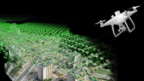
Master advanced UAV Photogrammetry flight planning and execution using DroneDeploy, Pix4D Capture, MapPilot, DJI Go4 with the most complete course on the market!
Achieve the most accurate results with UAV Photogrammetry on real-world examples.

Image acquisition, flight planning, camera settings and GCP (distribution, marking and measuring) are the most important steps in UAV Photogrammetry.
Remember that your final results will be only as good as your dataset!

This course covers:

    • Photogrammetry theory,
    • Recommended equipment for mapping,
    • Optimal camera settings,
    • Optimal flight parameters,
    • Flight planning and execution with various mission types,
    • GCP distribution, marking and measuring,
    • Tips and tricks,

and more!
This course is first part of 4 course series “Advanced Photogrammetry with Drones”. It is for beginner and advanced users.

If I had to describe this course series in one sentence, I would say “This is exactly the course I wish I had when I first started surveying with UAV Photogrammetry”.
Drone Mapping Tutorial

Who this course is for:
Little or more experienced drone operators
Land surveyors who want to learn UAV photogrammetry

Watch online or Download for Free
Part1 Planning and Execution 2019
1. Introduction

1. Introduction

2. Recommended hardware for mapping

1. Recommended UAVs for mapping
2. Recommended UAV accessories
3. Recommended equipment for GCP measureing

3. Theory

1. UAV Photogrammetry Theory
2. Flight Planning Theory
3. Optimal weather for UAV mapping

4. Planning the mission boundary in Google Earth PRO

1. Planning the mission boundary in Google Earth Pro

5. GCP – Ground Control Points

1. GCP Theory
2. Planning the GCPs location in Google Earth PRO
3. GCPs elevation calculation in EXCEL

6. Flight preparation and execution

1. Recommended camera and drone parameters for mapping
2. Pix4D Capture
3. DroneDeploy
4. DroneDeploy PhotoReport
5. MapPilot
6. Image acquisition plan for terrain with height variations
7. Large Area Mapping
8. Corridor Mapping

7. Tips and Tricks

1. Tips and Tricks

8. Epilogue

1. Epilogue

Part2 Pix4D Mapper 2019
1. Introduction

1. Introduction

2. Recommended PC setup

1. Recommended PC Specification for Pix4D Mapper
2. Prepare your PC
3. Tidy Things up

3. Theory

1. Theory
2. Outputs Definition

4. Step 1 Processing

2. Creating a New Project
3. Pix4D Mapper Interface
4. Step 1- Processing Options
5. Adding and Marking GCPs
6. Correcting the Ellipsoid Error
7. Quality Report
8. Processing Area
9. Tips and Tricks – Step 1

5. Step 2 Processing

1. Step 2 – Processing Options
2. Visual Inspection of Step 2 Results
3. Point Cloud Clean-up
4. Point Cloud Classification
5. Improving 3D Textured Mesh – Surfaces
6. Measuring on the Point Cloud
7. Video Animations

6. Step 3 Processing

1. Step 3 Processing Options
2. Volume Calculation
3. Editing Orthomosaic

7. Complete Workflow for the Metro Station Construction Project

1. Complete Workflow for the Metro Station Construction Project

8. Other

1. Tips and Tricks
2. Project Splitting and Merging
3. Orthoplane
4. Orientation Constraint
6. Pix4D Cloud Processing

[Udemy] Advanced UAV Photogrammetry (Part 1 & 2).7z
[Udemy] Advanced UAV Photogrammetry (Part 1 & 2)_Subtitles.7z


Join us on
  Channel    and      Group

  • Facebook
  • Twitter
  • Google+
  • Linkedin
  • Pinterest

Leave a Comment

Your email address will not be published. Required fields are marked *